Geolocate

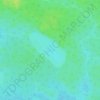
Brisay topographic map

Click on the map to display elevation.

About this map

Name: Brisay topographic map, elevation, terrain.

Location: Brisay, Eeyou Istchee James Bay, Jamésie, Nord-du-Québec, Quebec, Canada (54.42257 -70.55065 54.46257 -70.51065)

Average elevation: 1,745 ft

Minimum elevation: 1,591 ft

Maximum elevation: 2,041 ft

Other topographic maps

Click on a map to view its topography, its elevation and its terrain.
Lac Windfall

Canada > Quebec > Jamésie > Eeyou Istchee James Bay

Average elevation: 1,335 ft

Lac Nantel

Canada > Quebec > Jamésie > Eeyou Istchee James Bay

Average elevation: 889 ft

Lac Brigitte

Canada > Quebec > Jamésie > Eeyou Istchee James Bay

Average elevation: 1,358 ft

Lac Cameron

Canada > Quebec > Jamésie > Eeyou Istchee James Bay

Average elevation: 1,063 ft

Gear up for your next adventure:

🥩Freeze-Dried Meals - Nutritious and lightweight food for remote expeditions
📶Vehicle Signal Boosters - Improve reception in rural areas while driving to trailheads
🎒Waterproof Dry Bags - Keep your electronics and maps dry inside your pack
🗃️Trail First Aid Kit - Essential kit for outdoor injuries and emergencies
🎁Geography Themed Gifts - Unique gift ideas for map lovers and geography enthusiasts

As an Amazon Associate, this site earns from qualifying purchases at no extra cost to you.