Geolocate

Rundu topographic map

Click on the map to display elevation.

About this map
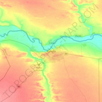
Name: Rundu topographic map, elevation, terrain.

Location: Rundu, Kavango East, Namibia (-18.07372 19.60725 -17.75372 19.92725)

Average elevation: 3,619 ft

Minimum elevation: 3,474 ft

Maximum elevation: 3,757 ft

Gear up for your next adventure:

🛰️Handheld GPS Units - Professional satellite navigators for precise backcountry mapping
👖Convertible Hiking Pants - Versatile zip-off pants for changing altitudes and temperatures
🛡️Insect Repellent - Protection against bugs during outdoor activities
⛑️Personal Locator Beacon - Safety beacon for emergencies
📱Heavy-Duty Phone Cases - Drop-proof and waterproof protection for outdoor navigation

As an Amazon Associate, this site earns from qualifying purchases at no extra cost to you.