Geolocate

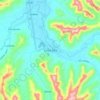
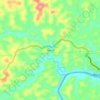
Paján topographic map

Click on the map to display elevation.

About this map

Name: Paján topographic map, elevation, terrain.

Location: Paján, Manabí, 130904, Ecuador (-1.95153 -80.57554 -1.45667 -80.18304)

Average elevation: 883 ft

Minimum elevation: 98 ft

Maximum elevation: 2,740 ft

Other topographic maps

Click on a map to view its topography, its elevation and its terrain.
Solano

Ecuador > Manabí > Pichincha > Pichincha

Average elevation: 230 ft

Santa Ana

Ecuador > Manabí > Santa Ana

Average elevation: 463 ft

La Union

Ecuador > Manabí > El Carmen > Santa María

Average elevation: 381 ft

Cordillera de Balzar

Ecuador > Manabí > Bolívar > Membrillo

Average elevation: 1,243 ft

Cojimíes

Ecuador > Manabí > Pedernales

Average elevation: 3 ft

Gear up for your next adventure:

📶Satellite Messenger - Communication device off‑grid
📶Vehicle Signal Boosters - Improve reception in rural areas while driving to trailheads
📌Outdoor GPS Map App - Apps and devices for digital topographic navigation
🪶Thermal Camp Blanket - Extra warmth for cold nights
🛡️Bear Spray Outdoor - Protection in bear country hikes

As an Amazon Associate, this site earns from qualifying purchases at no extra cost to you.