
Thank you for supporting this site ❤️
Make a donation
Make a donation
Gear up for your next adventure:
As an Amazon Associate, this site earns from qualifying purchases at no extra cost to you.
Itanará topographic map
Click on the map to display elevation.
Thank you for supporting this site ❤️
Make a donation
Make a donation
Gear up for your next adventure:
As an Amazon Associate, this site earns from qualifying purchases at no extra cost to you.
About this map
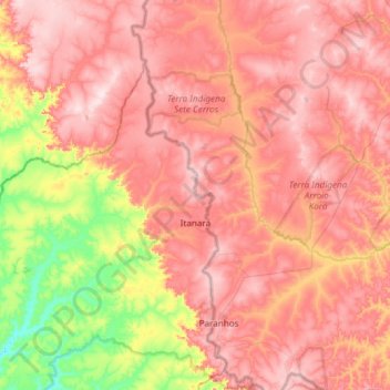
Name: Itanará topographic map, elevation, terrain.
Location: Itanará, Canindeyú, Región Oriental, Paraguay (-23.90416 -56.02721 -23.52359 -55.43005)
Average elevation: 1,122 ft
Minimum elevation: 463 ft
Maximum elevation: 1,604 ft
Thank you for supporting this site ❤️
Make a donation
Make a donation
Gear up for your next adventure:
As an Amazon Associate, this site earns from qualifying purchases at no extra cost to you.