
Thank you for supporting this site ❤️
Make a donation
Make a donation
Gear up for your next adventure:
As an Amazon Associate, this site earns from qualifying purchases at no extra cost to you.
sakari topographic map
Click on the map to display elevation.
Thank you for supporting this site ❤️
Make a donation
Make a donation
Gear up for your next adventure:
As an Amazon Associate, this site earns from qualifying purchases at no extra cost to you.
About this map
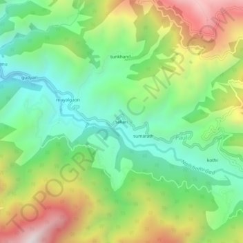
Name: sakari topographic map, elevation, terrain.
Location: sakari, Pauli, Ghansali, Tehri Garhwal, Uttarakhand, India (30.37354 78.71021 30.41354 78.75021)
Average elevation: 4,820 ft
Minimum elevation: 3,448 ft
Maximum elevation: 7,057 ft
Thank you for supporting this site ❤️
Make a donation
Make a donation
Gear up for your next adventure:
As an Amazon Associate, this site earns from qualifying purchases at no extra cost to you.