
Lamont topographic map
Interactive map
Click on the map to display elevation.
About this map
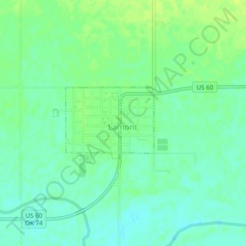
Name: Lamont topographic map, elevation, terrain.
Location: Lamont, Grant County, Oklahoma, 74643, United States (36.68714 -97.56597 36.69496 -97.55216)
Average elevation: 1,010 ft
Minimum elevation: 984 ft
Maximum elevation: 1,037 ft
Other topographic maps
Click on a map to view its topography, its elevation and its terrain.
Nash
United States > Oklahoma > Grant County
Nash, Grant County, Oklahoma, 73761, United States
Average elevation: 1,129 ft
Renfrow
United States > Oklahoma > Grant County
Renfrow, Grant County, Oklahoma, United States
Average elevation: 1,211 ft
Wakita
United States > Oklahoma > Grant County
Wakita, Grant County, Oklahoma, 73771, United States
Average elevation: 1,168 ft
Manchester
United States > Oklahoma > Grant County
Manchester, Grant County, Oklahoma, United States
Average elevation: 1,280 ft
Deer Creek
United States > Oklahoma > Grant County
Deer Creek, Grant County, Oklahoma, 74636, United States
Average elevation: 1,079 ft
Pond Creek
United States > Oklahoma > Grant County
Pond Creek, Grant County, Oklahoma, 73766, United States
Average elevation: 1,053 ft
Medford
United States > Oklahoma > Grant County
Medford, Grant County, Oklahoma, 73759, United States
Average elevation: 1,086 ft