Geolocate

Wakro topographic map

Click on the map to display elevation.

About this map

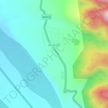
Name: Wakro topographic map, elevation, terrain.

Location: Wakro, Wakro Circle, Lohit district, Arunachal Pradesh, India (27.77121 96.34408 27.78625 96.35475)

Average elevation: 1,529 ft

Minimum elevation: 1,063 ft

Maximum elevation: 3,009 ft

Gear up for your next adventure:

🪶Trail Camera - Capture wildlife on your hikes
🧢Sun Protection Hats - Wide-brimmed and UPF-rated hats for high-altitude sun safety
🌡️Handheld Weather Meters - Measure wind, temp, and pressure for safe mountain travel
🎒Day Hiking Backpack - Lightweight backpack perfect for day trips and outdoor adventures
🪶Paracord Bracelet - Survival bracelet with built‑in tools

As an Amazon Associate, this site earns from qualifying purchases at no extra cost to you.