Geolocate

Meisberg topographic map

Click on the map to display elevation.

About this map

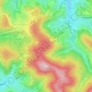
Name: Meisberg topographic map, elevation, terrain.

Location: Meisberg, Bessenbach, Landkreis Aschaffenburg, Bayern, 63856, Deutschland (49.93874 9.24095 49.93884 9.24105)

Average elevation: 988 ft

Minimum elevation: 627 ft

Maximum elevation: 1,417 ft

Other topographic maps

Click on a map to view its topography, its elevation and its terrain.

Gear up for your next adventure:

🪶Paracord Bracelet - Survival bracelet with built‑in tools
🧼Biodegradable Camping Soap - Eco‑friendly soap for outdoor hygiene
🪑Ultralight Camp Chairs - Portable seating for resting after a long day of mapping
Solar GPS Watches - Advanced multisport watches with built-in topographic maps
📷Action Camera - Capture your outdoor adventures in HD

As an Amazon Associate, this site earns from qualifying purchases at no extra cost to you.