
Northfield topographic map
Click on the map to display elevation.
About this map
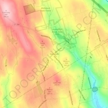
Name: Northfield topographic map, elevation, terrain.
Average elevation: 850 ft
Minimum elevation: 430 ft
Maximum elevation: 1,129 ft
Northwest Hills Planning Region trails, hiking, mountain biking, running and outdoor activities
Other topographic maps
Click on a map to view its topography, its elevation and its terrain.
Litchfield (borough)
United States > Connecticut > Northwest Hills Planning Region > Litchfield
Average elevation: 1,007 ft