
Thank you for supporting this site ❤️
Make a donation
Make a donation
Gear up for your next adventure:
As an Amazon Associate, this site earns from qualifying purchases at no extra cost to you.
Zufre topographic map
Click on the map to display elevation.
Thank you for supporting this site ❤️
Make a donation
Make a donation
Gear up for your next adventure:
As an Amazon Associate, this site earns from qualifying purchases at no extra cost to you.
About this map
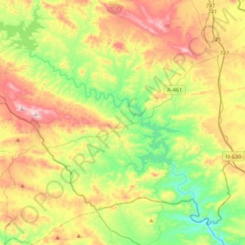
Name: Zufre topographic map, elevation, terrain.
Location: Zufre, Sierra de Huelva, Huelva, Andalusia, Spain (37.71886 -6.48508 37.95640 -6.20570)
Average elevation: 1,394 ft
Minimum elevation: 502 ft
Maximum elevation: 2,726 ft
Thank you for supporting this site ❤️
Make a donation
Make a donation
Gear up for your next adventure:
As an Amazon Associate, this site earns from qualifying purchases at no extra cost to you.