
Thank you for supporting this site ❤️
Make a donation
Make a donation
Gear up for your next adventure:
As an Amazon Associate, this site earns from qualifying purchases at no extra cost to you.
Samaipata topographic map
Click on the map to display elevation.
Thank you for supporting this site ❤️
Make a donation
Make a donation
Gear up for your next adventure:
As an Amazon Associate, this site earns from qualifying purchases at no extra cost to you.
About this map
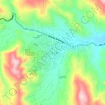
Name: Samaipata topographic map, elevation, terrain.
Location: Samaipata, Provincia Florida, Santa Cruz, Bolivia (-18.19966 -63.89583 -18.15966 -63.85583)
Average elevation: 5,646 ft
Minimum elevation: 5,230 ft
Maximum elevation: 6,322 ft
Thank you for supporting this site ❤️
Make a donation
Make a donation
Gear up for your next adventure:
As an Amazon Associate, this site earns from qualifying purchases at no extra cost to you.