Geolocate

Reseda topographic map

Click on the map to display elevation.

About this map

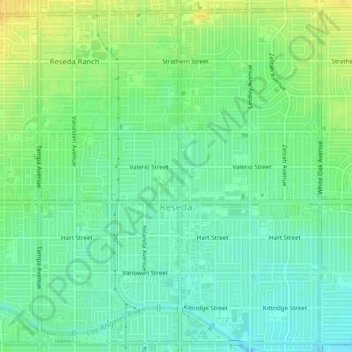
Name: Reseda topographic map, elevation, terrain.

Location: Reseda, Los Angeles, California, United States (34.18655 -118.56233 34.22103 -118.51853)

Average elevation: 758 ft

Minimum elevation: 722 ft

Maximum elevation: 801 ft

California trails, hiking, mountain biking, running and outdoor activities

Gear up for your next adventure:

🧢Outdoor Hiking Hat - Sun protection hat for outdoor explorers
🔌Solar Panel Charger - Charge gear sustainably outdoors
🧼Biodegradable Camping Soap - Eco‑friendly soap for outdoor hygiene
🩳Quick‑Dry Hiking Shorts - Comfortable and quick‑dry shorts for summer hiking
Solar GPS Watches - Advanced multisport watches with built-in topographic maps

As an Amazon Associate, this site earns from qualifying purchases at no extra cost to you.