
Thank you for supporting this site ❤️
Make a donation
Make a donation
Gear up for your next adventure:
As an Amazon Associate, this site earns from qualifying purchases at no extra cost to you.
Baghaï topographic map
Click on the map to display elevation.
Thank you for supporting this site ❤️
Make a donation
Make a donation
Gear up for your next adventure:
As an Amazon Associate, this site earns from qualifying purchases at no extra cost to you.
About this map
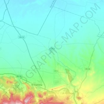
Name: Baghaï topographic map, elevation, terrain.
Location: Baghaï, El Hamma District, Khenchela, Algeria (35.44293 7.08496 35.59195 7.29291)
Average elevation: 3,061 ft
Minimum elevation: 2,736 ft
Maximum elevation: 4,439 ft
Thank you for supporting this site ❤️
Make a donation
Make a donation
Gear up for your next adventure:
As an Amazon Associate, this site earns from qualifying purchases at no extra cost to you.