Geolocate

Young topographic map

Click on the map to display elevation.

About this map

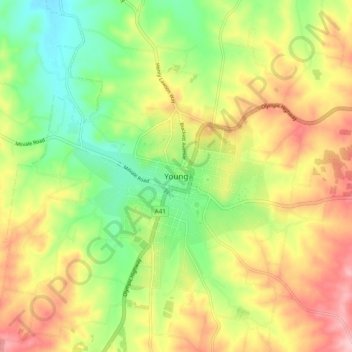
Name: Young topographic map, elevation, terrain.

Location: Young, Hilltops Council, New South Wales, Australia (-34.35035 148.25718 -34.27035 148.33718)

Average elevation: 1,552 ft

Minimum elevation: 1,283 ft

Maximum elevation: 1,860 ft

Gear up for your next adventure:

🛰️Satellite Messengers - Emergency SOS and two-way messaging for off-grid adventures
📌Outdoor GPS Map App - Apps and devices for digital topographic navigation
🥩Freeze-Dried Meals - Nutritious and lightweight food for remote expeditions
🎒Day Hiking Backpack - Lightweight backpack perfect for day trips and outdoor adventures
🥾Women's Hiking Boots - Top-rated trail boots with ankle support and superior grip

As an Amazon Associate, this site earns from qualifying purchases at no extra cost to you.