
Thank you for supporting this site ❤️
Make a donation
Make a donation
Gear up for your next adventure:
As an Amazon Associate, this site earns from qualifying purchases at no extra cost to you.
Estellencs topographic map
Click on the map to display elevation.
Thank you for supporting this site ❤️
Make a donation
Make a donation
Gear up for your next adventure:
As an Amazon Associate, this site earns from qualifying purchases at no extra cost to you.
About this map
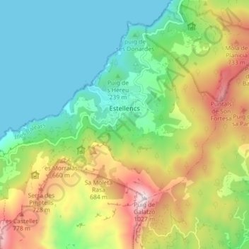
Name: Estellencs topographic map, elevation, terrain.
Location: Estellencs, Serra de Tramuntana, Balearic Islands, 07192, Spain (39.62750 2.43671 39.67246 2.50734)
Average elevation: 1,178 ft
Minimum elevation: -3 ft
Maximum elevation: 3,343 ft
Thank you for supporting this site ❤️
Make a donation
Make a donation
Gear up for your next adventure:
As an Amazon Associate, this site earns from qualifying purchases at no extra cost to you.