
Thank you for supporting this site ❤️
Make a donation
Make a donation
Gear up for your next adventure:
As an Amazon Associate, this site earns from qualifying purchases at no extra cost to you.
Roggenburg topographic map
Click on the map to display elevation.
Thank you for supporting this site ❤️
Make a donation
Make a donation
Gear up for your next adventure:
As an Amazon Associate, this site earns from qualifying purchases at no extra cost to you.
About this map
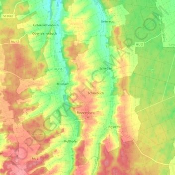
Name: Roggenburg topographic map, elevation, terrain.
Location: Roggenburg, Landkreis Neu-Ulm, Bavière, 89297, Allemagne (48.25030 10.18563 48.32329 10.26477)
Average elevation: 1,736 ft
Minimum elevation: 1,588 ft
Maximum elevation: 1,864 ft
Thank you for supporting this site ❤️
Make a donation
Make a donation
Gear up for your next adventure:
As an Amazon Associate, this site earns from qualifying purchases at no extra cost to you.