Geolocate

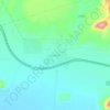
Grootfontein topographic map

Click on the map to display elevation.

About this map

Name: Grootfontein topographic map, elevation, terrain.

Location: Grootfontein, Otjozondjupa, 12010, Namibia (-19.59858 18.07905 -19.54540 18.11770)

Average elevation: 4,744 ft

Minimum elevation: 4,583 ft

Maximum elevation: 4,941 ft

Other topographic maps

Click on a map to view its topography, its elevation and its terrain.

Small Waterberg

Namibia > Otjozondjupa

Average elevation: 5,692 ft

Okatjoruu

Namibia > Otjozondjupa

Average elevation: 4,006 ft

Kombat

Namibia > Otjozondjupa

Average elevation: 5,289 ft

Otavi

Namibia > Otjozondjupa

Average elevation: 4,646 ft

Tsumkwe (Boundaries)

Namibia > Otjozondjupa

Average elevation: 3,780 ft

Teufelsbach

Namibia > Otjozondjupa

Average elevation: 4,511 ft

Gear up for your next adventure:

🩳Quick‑Dry Hiking Shorts - Comfortable and quick‑dry shorts for summer hiking
❄️Traction Cleats - Prevent slips on icy trails during winter hikes
⛑️Personal Locator Beacon - Safety beacon for emergencies
📖Nature Tracking Books - Learn to track wildlife and terrain
🧣Hiking Neck Gaiter - Multi‑use neck protection for outdoor weather

As an Amazon Associate, this site earns from qualifying purchases at no extra cost to you.