
Thank you for supporting this site ❤️
Make a donation
Make a donation
Gear up for your next adventure:
As an Amazon Associate, this site earns from qualifying purchases at no extra cost to you.
Onconashari topographic map
Click on the map to display elevation.
Thank you for supporting this site ❤️
Make a donation
Make a donation
Gear up for your next adventure:
As an Amazon Associate, this site earns from qualifying purchases at no extra cost to you.
About this map
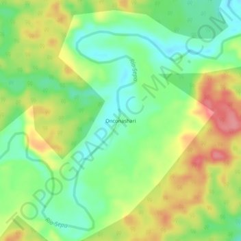
Name: Onconashari topographic map, elevation, terrain.
Location: Onconashari, Sepahua, Atalaya, Ucayali, Perú (-11.11468 -73.39187 -11.07468 -73.35187)
Average elevation: 1,093 ft
Minimum elevation: 965 ft
Maximum elevation: 1,260 ft
Thank you for supporting this site ❤️
Make a donation
Make a donation
Gear up for your next adventure:
As an Amazon Associate, this site earns from qualifying purchases at no extra cost to you.