Geolocate

Patallacta topographic map

Click on the map to display elevation.

About this map

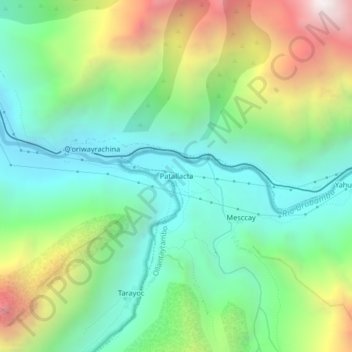
Name: Patallacta topographic map, elevation, terrain.

Location: Patallacta, Ollantaytambo, Urubamba, Cusco, Perú (-13.24796 -72.44375 -13.20796 -72.40375)

Average elevation: 9,970 ft

Minimum elevation: 8,058 ft

Maximum elevation: 13,852 ft

Gear up for your next adventure:

🏕️Tent Footprint - Protect your tent base from wear
🪶Fire Starter Kit - Reliable fire starter for survival and camping
GPS Sports Watch - GPS watch for running, hiking and training
📌Outdoor GPS Map App - Apps and devices for digital topographic navigation
📚USA Hiking Guide Books - Top trail guides and map books

As an Amazon Associate, this site earns from qualifying purchases at no extra cost to you.