Geolocate

Matamoros topographic map

Click on the map to display elevation.

About this map

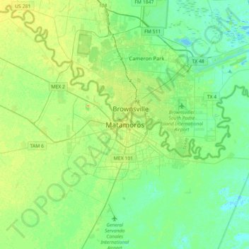
Name: Matamoros topographic map, elevation, terrain.

Location: Matamoros, Tamaulipas, 87300, Mexico (25.72102 -97.66649 26.04102 -97.34649)

Average elevation: 30 ft

Minimum elevation: -7 ft

Maximum elevation: 82 ft

Gear up for your next adventure:

🥩Freeze-Dried Meals - Nutritious and lightweight food for remote expeditions
🌡️Handheld Weather Meters - Measure wind, temp, and pressure for safe mountain travel
🧴Hand Sanitizer - Keep hands clean while hiking
🕶️Glacier Sunglasses - Side shields to protect eyes from high-altitude snow glare
🧤Hiking Gloves - Protective gloves for rugged trails

As an Amazon Associate, this site earns from qualifying purchases at no extra cost to you.