
Thank you for supporting this site ❤️
Make a donation
Make a donation
Gear up for your next adventure:
As an Amazon Associate, this site earns from qualifying purchases at no extra cost to you.
Tébar topographic map
Click on the map to display elevation.
Thank you for supporting this site ❤️
Make a donation
Make a donation
Gear up for your next adventure:
As an Amazon Associate, this site earns from qualifying purchases at no extra cost to you.
About this map
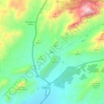
Name: Tébar topographic map, elevation, terrain.
Location: Tébar, Águilas, Alto Guadalentín, Murcia, Spanje (37.49099 -1.64447 37.53099 -1.60447)
Average elevation: 1,555 ft
Minimum elevation: 994 ft
Maximum elevation: 2,667 ft
Thank you for supporting this site ❤️
Make a donation
Make a donation
Gear up for your next adventure:
As an Amazon Associate, this site earns from qualifying purchases at no extra cost to you.