
Thank you for supporting this site ❤️
Make a donation
Make a donation
Gear up for your next adventure:
As an Amazon Associate, this site earns from qualifying purchases at no extra cost to you.
Tabernilla topographic map
Click on the map to display elevation.
Thank you for supporting this site ❤️
Make a donation
Make a donation
Gear up for your next adventure:
As an Amazon Associate, this site earns from qualifying purchases at no extra cost to you.
About this map
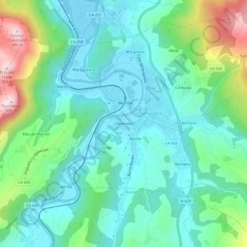
Name: Tabernilla topographic map, elevation, terrain.
Location: Tabernilla, Ampuero, Cantabria, 39849, España (43.32238 -3.44136 43.36238 -3.40136)
Average elevation: 400 ft
Minimum elevation: -3 ft
Maximum elevation: 1,617 ft
Thank you for supporting this site ❤️
Make a donation
Make a donation
Gear up for your next adventure:
As an Amazon Associate, this site earns from qualifying purchases at no extra cost to you.