
Thank you for supporting this site ❤️
Make a donation
Make a donation
Gear up for your next adventure:
As an Amazon Associate, this site earns from qualifying purchases at no extra cost to you.
Purires topographic map
Click on the map to display elevation.
Thank you for supporting this site ❤️
Make a donation
Make a donation
Gear up for your next adventure:
As an Amazon Associate, this site earns from qualifying purchases at no extra cost to you.
About this map
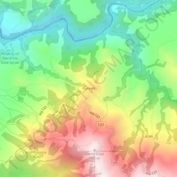
Name: Purires topographic map, elevation, terrain.
Location: Purires, San Pablo, Turrubares, San José, 11601, Costa Rica (9.88962 -84.43823 9.92962 -84.39823)
Average elevation: 1,631 ft
Minimum elevation: 568 ft
Maximum elevation: 3,064 ft
Thank you for supporting this site ❤️
Make a donation
Make a donation
Gear up for your next adventure:
As an Amazon Associate, this site earns from qualifying purchases at no extra cost to you.