
Thank you for supporting this site ❤️
Make a donation
Make a donation
Gear up for your next adventure:
As an Amazon Associate, this site earns from qualifying purchases at no extra cost to you.
Sant'Elia topographic map
Click on the map to display elevation.
Thank you for supporting this site ❤️
Make a donation
Make a donation
Gear up for your next adventure:
As an Amazon Associate, this site earns from qualifying purchases at no extra cost to you.
About this map
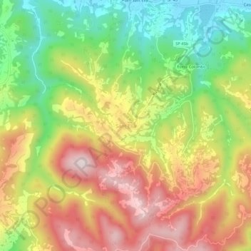
Name: Sant'Elia topographic map, elevation, terrain.
Location: Sant'Elia, Rieti, Lazio, Italia (42.34983 12.79435 42.38983 12.83435)
Average elevation: 2,067 ft
Minimum elevation: 1,260 ft
Maximum elevation: 2,907 ft
Thank you for supporting this site ❤️
Make a donation
Make a donation
Gear up for your next adventure:
As an Amazon Associate, this site earns from qualifying purchases at no extra cost to you.