
Make a donation
Gear up for your next adventure:
As an Amazon Associate, this site earns from qualifying purchases at no extra cost to you.
Houten topographic map
Click on the map to display elevation.
Make a donation
Gear up for your next adventure:
As an Amazon Associate, this site earns from qualifying purchases at no extra cost to you.
Houten
De volgende straten, lanen, pleinen, parken en andere topografische aanduidingen hebben een eigen artikel op Wikipedia.
Make a donation
Gear up for your next adventure:
As an Amazon Associate, this site earns from qualifying purchases at no extra cost to you.
About this map
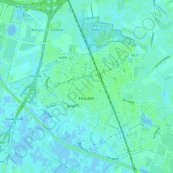
Name: Houten topographic map, elevation, terrain.
Location: Houten, Utrecht, Nederland (52.00473 5.12177 52.05676 5.20353)
Average elevation: 7 ft
Minimum elevation: -13 ft
Maximum elevation: 20 ft
Make a donation
Gear up for your next adventure:
As an Amazon Associate, this site earns from qualifying purchases at no extra cost to you.
Other topographic maps
Click on a map to view its topography, its elevation and its terrain.