
Thank you for supporting this site ❤️
Make a donation
Make a donation
Gear up for your next adventure:
As an Amazon Associate, this site earns from qualifying purchases at no extra cost to you.
Nahualate topographic map
Click on the map to display elevation.
Thank you for supporting this site ❤️
Make a donation
Make a donation
Gear up for your next adventure:
As an Amazon Associate, this site earns from qualifying purchases at no extra cost to you.
About this map
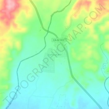
Name: Nahualate topographic map, elevation, terrain.
Location: Nahualate, Chicacao, Suchitepéquez, Guatemala (14.41833 -91.40034 14.45833 -91.36034)
Average elevation: 528 ft
Minimum elevation: 374 ft
Maximum elevation: 850 ft
Thank you for supporting this site ❤️
Make a donation
Make a donation
Gear up for your next adventure:
As an Amazon Associate, this site earns from qualifying purchases at no extra cost to you.