
Thank you for supporting this site ❤️
Make a donation
Make a donation
Gear up for your next adventure:
As an Amazon Associate, this site earns from qualifying purchases at no extra cost to you.
Lechbruck am See topographic map
Click on the map to display elevation.
Thank you for supporting this site ❤️
Make a donation
Make a donation
Gear up for your next adventure:
As an Amazon Associate, this site earns from qualifying purchases at no extra cost to you.
About this map
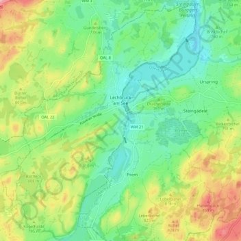
Name: Lechbruck am See topographic map, elevation, terrain.
Location: Lechbruck am See, Landkreis Ostallgäu, Bavaria, 86983, Germany (47.65775 10.74028 47.72787 10.82944)
Average elevation: 2,533 ft
Minimum elevation: 2,333 ft
Maximum elevation: 2,894 ft
Thank you for supporting this site ❤️
Make a donation
Make a donation
Gear up for your next adventure:
As an Amazon Associate, this site earns from qualifying purchases at no extra cost to you.