
Hirschberg topographic map
Click on the map to display elevation.
Hirschberg
Das Kirchdorf Hirschberg liegt nordwestlich von Beilngries oberhalb des Altmühltals auf circa 490 m Meereshöhe. Das Dorf breitet sich westlich einer von Schloss Hirschberg beherrschten Bergzunge, dem Hirschberg, auf dem Hochplateau der Fränkischen Alb aus. Durch den Ort führt in gerader Linie die sogenannte Fürstenstraße, die von Fürstbischof Raymund Anton Graf von Strasoldo von Kinding aus durch den Haunstetter Forst zum Schloss hin angelegt wurde.
About this map
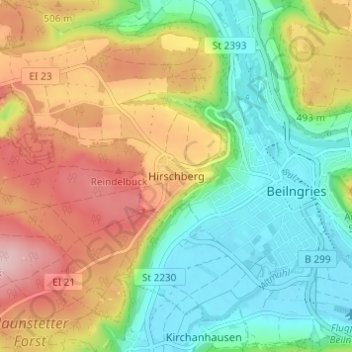
Name: Hirschberg topographic map, elevation, terrain.
Average elevation: 1,476 ft
Minimum elevation: 1,194 ft
Maximum elevation: 1,880 ft
Other topographic maps
Click on a map to view its topography, its elevation and its terrain.
92339
Deutschland > Bayern > Landkreis Eichstätt > Beilngries > Paulushofen > Leising
Average elevation: 1,572 ft