
Make a donation
Gear up for your next adventure:
As an Amazon Associate, this site earns from qualifying purchases at no extra cost to you.
Lantenbach topographic map
Click on the map to display elevation.
Make a donation
Gear up for your next adventure:
As an Amazon Associate, this site earns from qualifying purchases at no extra cost to you.
About this map
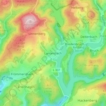
Name: Lantenbach topographic map, elevation, terrain.
Average elevation: 1,158 ft
Minimum elevation: 804 ft
Maximum elevation: 1,677 ft
Make a donation
Gear up for your next adventure:
As an Amazon Associate, this site earns from qualifying purchases at no extra cost to you.
Other topographic maps
Click on a map to view its topography, its elevation and its terrain.
51645
Deutschland > Nordrhein-Westfalen > Oberbergischer Kreis > Gummersbach > Niederseßmar
Average elevation: 827 ft
Strombach
Deutschland > Nordrhein-Westfalen > Oberbergischer Kreis > Gummersbach
Average elevation: 974 ft
51647
Deutschland > Nordrhein-Westfalen > Oberbergischer Kreis > Gummersbach
Average elevation: 1,024 ft
51643
Deutschland > Nordrhein-Westfalen > Oberbergischer Kreis > Gummersbach
Average elevation: 965 ft
Make a donation
Gear up for your next adventure:
As an Amazon Associate, this site earns from qualifying purchases at no extra cost to you.
Aggertalsperre
Deutschland > Nordrhein-Westfalen > Oberbergischer Kreis > Gummersbach > Bredenbruch
Average elevation: 1,086 ft
Genkeltalsperre
Deutschland > Nordrhein-Westfalen > Oberbergischer Kreis > Gummersbach > Helberg
Der Staudamm der Genkeltalsperre besteht aus einer Steinschüttung ohne Vermörtelung. Auf der Wasserseite ist er mit einer doppelten Asphaltbetondecke wasserdicht abgedeckt. Auf der Luftseite wurde die Böschung mit Rasen- und Strauchgruppen landschaftsgerecht gestaltet. Die Höhe des Dammes beträgt 41 m…
Average elevation: 1,283 ft
Lieberhausen
Deutschland > Nordrhein-Westfalen > Oberbergischer Kreis > Gummersbach
Average elevation: 1,201 ft
Dieringhausen
Deutschland > Nordrhein-Westfalen > Oberbergischer Kreis > Gummersbach
Average elevation: 801 ft
Make a donation
Gear up for your next adventure:
As an Amazon Associate, this site earns from qualifying purchases at no extra cost to you.
Strombach
Deutschland > Nordrhein-Westfalen > Oberbergischer Kreis > Gummersbach
Average elevation: 978 ft