
Make a donation
Gear up for your next adventure:
As an Amazon Associate, this site earns from qualifying purchases at no extra cost to you.
Quillabamba topographic map
Click on the map to display elevation.
Make a donation
Gear up for your next adventure:
As an Amazon Associate, this site earns from qualifying purchases at no extra cost to you.
Quillabamba
Die Stadt liegt auf einer Höhe von 1063 m am linken Flussufer des Río Urubamba und ist von bis zu 4000 m hohen Bergen umgeben.
Make a donation
Gear up for your next adventure:
As an Amazon Associate, this site earns from qualifying purchases at no extra cost to you.
About this map
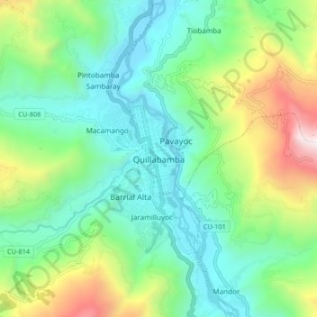
Name: Quillabamba topographic map, elevation, terrain.
Location: Quillabamba, Santa Ana, La Convención, Cusco, 08741, Peru (-12.90635 -72.73244 -12.82635 -72.65244)
Average elevation: 4,823 ft
Minimum elevation: 3,159 ft
Maximum elevation: 9,029 ft
Make a donation
Gear up for your next adventure:
As an Amazon Associate, this site earns from qualifying purchases at no extra cost to you.