
Thank you for supporting this site ❤️
Make a donation
Make a donation
Gear up for your next adventure:
As an Amazon Associate, this site earns from qualifying purchases at no extra cost to you.
Chasquitambo topographic map
Click on the map to display elevation.
Thank you for supporting this site ❤️
Make a donation
Make a donation
Gear up for your next adventure:
As an Amazon Associate, this site earns from qualifying purchases at no extra cost to you.
About this map
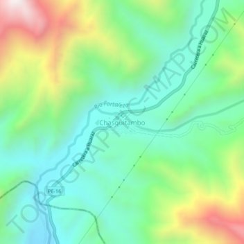
Name: Chasquitambo topographic map, elevation, terrain.
Location: Chasquitambo, Colquioc, Bolognesi, Áncash, Perú (-10.33236 -77.63486 -10.29236 -77.59486)
Average elevation: 3,173 ft
Minimum elevation: 2,070 ft
Maximum elevation: 5,610 ft
Thank you for supporting this site ❤️
Make a donation
Make a donation
Gear up for your next adventure:
As an Amazon Associate, this site earns from qualifying purchases at no extra cost to you.