Geolocate

Kalkoda topographic map

Click on the map to display elevation.

Kalkoda

Kalkoda is located at 17°28′31″N 77°43′34″E / 17.475388°N 77.726030°E / 17.475388; 77.726030. It has an average elevation of 617 metres (2027 ft).

Wikipedia (CC-BY-SA 3.0)

About this map

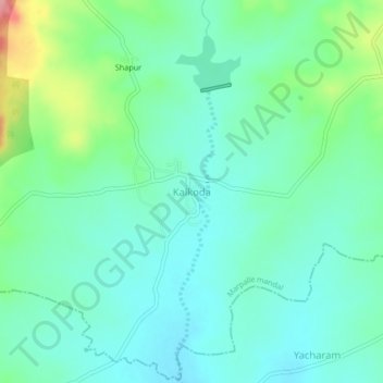
Name: Kalkoda topographic map, elevation, terrain.

Location: Kalkoda, Marpalle mandal, Vikarabad, Telangana, India (17.45351 77.70739 17.49351 77.74739)

Average elevation: 1,936 ft

Minimum elevation: 1,844 ft

Maximum elevation: 2,221 ft

Gear up for your next adventure:

🏕️Family Camping Gear - Essentials for group camping trips
🧭Pro Hiking Compasses - High-accuracy liquid-filled compasses for topographic orientation
📚Navigation Handbooks - Master the art of reading topographic maps and using a compass
🗃️Trail First Aid Kit - Essential kit for outdoor injuries and emergencies
🔌USB Car Charger - Car charger for on‑the‑go power needs

As an Amazon Associate, this site earns from qualifying purchases at no extra cost to you.