
Thank you for supporting this site ❤️
Make a donation
Make a donation
Gear up for your next adventure:
As an Amazon Associate, this site earns from qualifying purchases at no extra cost to you.
Minceto topographic map
Click on the map to display elevation.
Thank you for supporting this site ❤️
Make a donation
Make a donation
Gear up for your next adventure:
As an Amazon Associate, this site earns from qualifying purchases at no extra cost to you.
About this map
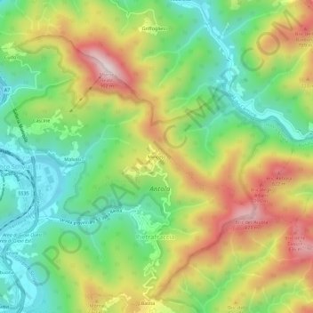
Name: Minceto topographic map, elevation, terrain.
Location: Minceto, Ronco Scrivia, Genova, Liguria, 16019, Italia (44.59453 8.95854 44.63453 8.99854)
Average elevation: 1,765 ft
Minimum elevation: 1,001 ft
Maximum elevation: 2,858 ft
Thank you for supporting this site ❤️
Make a donation
Make a donation
Gear up for your next adventure:
As an Amazon Associate, this site earns from qualifying purchases at no extra cost to you.