
山斗乡 topographic map
Interactive map
Click on the map to display elevation.
About this map
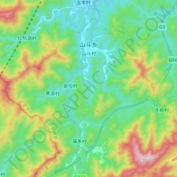
Name: 山斗乡 topographic map, elevation, terrain.
Location: 山斗乡, 休宁县, 黄山市, 安徽省, 中国 (29.48871 118.10041 29.57677 118.22784)
Average elevation: 1,391 ft
Minimum elevation: 495 ft
Maximum elevation: 3,589 ft
Other topographic maps
Click on a map to view its topography, its elevation and its terrain.