
隆格尔乡 topographic map
Interactive map
Click on the map to display elevation.
About this map
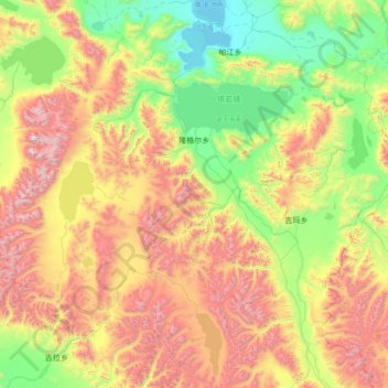
Name: 隆格尔乡 topographic map, elevation, terrain.
Location: 隆格尔乡, 仲巴县, 日喀则市, 西藏自治区, 中国 (30.28451 83.30017 31.45762 84.32741)
Average elevation: 16,900 ft
Minimum elevation: 14,511 ft
Maximum elevation: 21,614 ft
Other topographic maps
Click on a map to view its topography, its elevation and its terrain.