
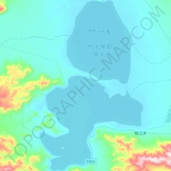
扎布耶茶卡 topographic map
Interactive map
Click on the map to display elevation.
About this map
Name: 扎布耶茶卡 topographic map, elevation, terrain.
Location: 扎布耶茶卡, 丁什线, 仲巴县, 日喀则市, 西藏自治区, 中国 (31.24569 83.94160 31.51068 84.13040)
Average elevation: 14,780 ft
Minimum elevation: 14,505 ft
Maximum elevation: 17,287 ft
扎布耶茶卡(藏语:གྲག་ཡེར་ཚྭ་ཁ,威利:grag yer tshwa kha)也称扎布耶措、扎布耶湖,位于中国西藏自治区西部仲巴县境内。面积235平方公里,湖面海拔4400米。
Other topographic maps
Click on a map to view its topography, its elevation and its terrain.