Geolocate

Umbraj topographic map

Click on the map to display elevation.

About this map

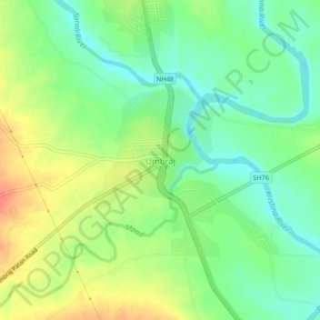
Name: Umbraj topographic map, elevation, terrain.

Location: Umbraj, Karad, Satara, Maharashtra, 415109, India (17.38096 74.08063 17.42096 74.12063)

Average elevation: 1,949 ft

Minimum elevation: 1,873 ft

Maximum elevation: 2,047 ft

Gear up for your next adventure:

🪄Magnetic Compass - Accurate compass for navigation
🎁Geography Themed Gifts - Unique gift ideas for map lovers and geography enthusiasts
🛏️Cold Weather Sleeping Bag - Warm sleeping bag for cold conditions
🧭Map Reading Tools - Tools and kits for map navigation
Camping Coffee Makers - Enjoy premium coffee at the summit or campsite

As an Amazon Associate, this site earns from qualifying purchases at no extra cost to you.