Geolocate

Concho Overlook topographic map

Click on the map to display elevation.

About this map
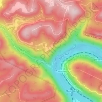
Name: Concho Overlook topographic map, elevation, terrain.

Location: Concho Overlook, Southside Trail, Dimmock, Fayette County, West Virginia, 25936, United States (37.96675 -81.08593 37.96685 -81.08583)

Average elevation: 1,627 ft

Minimum elevation: 1,001 ft

Maximum elevation: 2,018 ft

Fayette County trails, hiking, mountain biking, running and outdoor activities

Gear up for your next adventure:

📱Heavy-Duty Phone Cases - Drop-proof and waterproof protection for outdoor navigation
📻Weather Alert Radios - Stay informed of storm risks while off-the-grid
🧤Tactile Hiking Gloves - Keep hands warm while operating GPS and smartphone screens
🏕️Family Camping Gear - Essentials for group camping trips
🪵Folding Camp Saw - Compact saw for wood and campsite work

As an Amazon Associate, this site earns from qualifying purchases at no extra cost to you.