
杉城镇 topographic map
Interactive map
Click on the map to display elevation.
About this map
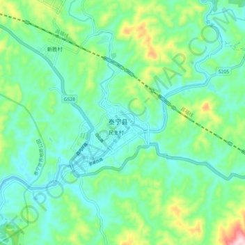
Name: 杉城镇 topographic map, elevation, terrain.
Location: 杉城镇, 泰宁县, 三明市, 福建省, 中国 (26.86254 117.13220 26.94254 117.21220)
Average elevation: 1,129 ft
Minimum elevation: 866 ft
Maximum elevation: 1,929 ft
Other topographic maps
Click on a map to view its topography, its elevation and its terrain.