
Thank you for supporting this site ❤️
Make a donation
Make a donation
Gear up for your next adventure:
As an Amazon Associate, this site earns from qualifying purchases at no extra cost to you.
Cahigam topographic map
Click on the map to display elevation.
Thank you for supporting this site ❤️
Make a donation
Make a donation
Gear up for your next adventure:
As an Amazon Associate, this site earns from qualifying purchases at no extra cost to you.
About this map
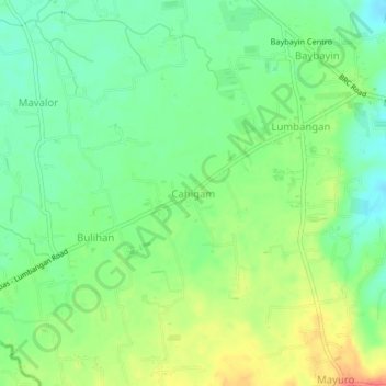
Name: Cahigam topographic map, elevation, terrain.
Location: Cahigam, Rosario, Batangas, Calabarzon, 4225, Philippines (13.78969 121.22900 13.82969 121.26900)
Average elevation: 446 ft
Minimum elevation: 371 ft
Maximum elevation: 558 ft
Thank you for supporting this site ❤️
Make a donation
Make a donation
Gear up for your next adventure:
As an Amazon Associate, this site earns from qualifying purchases at no extra cost to you.