
Ridgway State Park topographic map
Interactive map
Click on the map to display elevation.
About this map
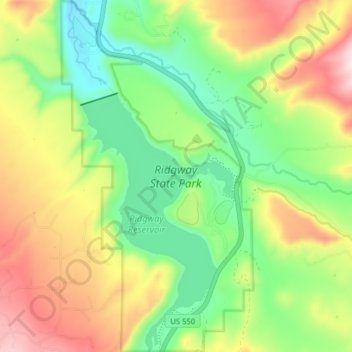
Name: Ridgway State Park topographic map, elevation, terrain.
Location: Ridgway State Park, Ouray County, Colorado, United States (38.19181 -107.76774 38.25398 -107.72420)
Average elevation: 7,195 ft
Minimum elevation: 6,617 ft
Maximum elevation: 8,025 ft
Other topographic maps
Click on a map to view its topography, its elevation and its terrain.
Ridgway
United States > Colorado > Ouray County
Ridgway, Ouray County, Colorado, United States
Average elevation: 7,129 ft
Thistledown
United States > Colorado > Ouray County
Thistledown, Ouray County, Colorado, 81427, United States
Average elevation: 10,282 ft
Mount Sneffels
United States > Colorado > Ouray County
Mount Sneffels, Ouray County, Colorado, United States
Average elevation: 12,247 ft