Bramhanwada Pathak topographic map
Interactive map
Click on the map to display elevation.
About this map
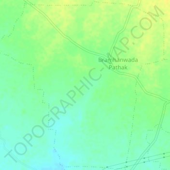
Name: Bramhanwada Pathak topographic map, elevation, terrain.
Location: Bramhanwada Pathak, Chandurbazar, Amravati, Maharashtra, India (21.27346 77.74005 21.30341 77.77260)
Average elevation: 1,286 ft
Minimum elevation: 1,253 ft
Maximum elevation: 1,322 ft
Other topographic maps
Click on a map to view its topography, its elevation and its terrain.
Ratanpur
India > Maharashtra > Chandurbazar
Ratanpur, Chandurbazar, Amravati, Maharashtra, India
Average elevation: 1,339 ft
Belora
India > Maharashtra > Chandurbazar
Belora, Chandurbazar, Amravati, Maharashtra, India
Average elevation: 1,168 ft