Geolocate

Mille topographic map

Click on the map to display elevation.

About this map

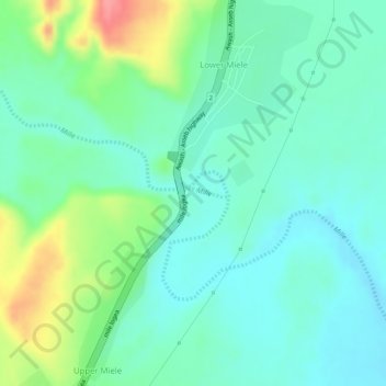
Name: Mille topographic map, elevation, terrain.

Location: Mille, Lower Miele, Zone 1, Afar Region, Ethiopia (11.41353 40.75924 11.41412 40.76277)

Average elevation: 1,627 ft

Minimum elevation: 1,535 ft

Maximum elevation: 1,831 ft

Gear up for your next adventure:

🔥Fast-Boil Camping Stoves - Efficient cooking systems for quick trail meals
🪑Ultralight Camp Chairs - Portable seating for resting after a long day of mapping
🌄Hiking Binoculars - Compact binoculars for scenic views and trail spotting
Solar GPS Watches - Advanced multisport watches with built-in topographic maps
🧢Sun Protection Hats - Wide-brimmed and UPF-rated hats for high-altitude sun safety

As an Amazon Associate, this site earns from qualifying purchases at no extra cost to you.