
Make a donation
Gear up for your next adventure:
As an Amazon Associate, this site earns from qualifying purchases at no extra cost to you.
Rütenbrock topographic map
Click on the map to display elevation.
Make a donation
Gear up for your next adventure:
As an Amazon Associate, this site earns from qualifying purchases at no extra cost to you.
Rütenbrock
Rütenbrock partizipiert von der starken Kaufkraft der nahen niederländischen Provinzen Drenthe mit der Stadt Emmen und Groningen mit den Gemeinden Vlagtwedde und Ter Apel. Der niedrigere deutsche Mehrwertsteuersatz zieht zum günstigeren Einkaufen und Tanken nach Rütenbrock. Zudem lassen sich viele Niederländer aus den angrenzenden niederländischen Provinzen aufgrund des höheren Preisniveaus von niederländischen Grundstücken und/oder Immobilien sowie des höheren Mietspiegels in dem grenznahen Ort nieder.
Make a donation
Gear up for your next adventure:
As an Amazon Associate, this site earns from qualifying purchases at no extra cost to you.
About this map
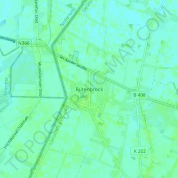
Name: Rütenbrock topographic map, elevation, terrain.
Average elevation: 43 ft
Minimum elevation: 33 ft
Maximum elevation: 56 ft
Make a donation
Gear up for your next adventure:
As an Amazon Associate, this site earns from qualifying purchases at no extra cost to you.
Other topographic maps
Click on a map to view its topography, its elevation and its terrain.
Schloss Dankern
Deutschland > Niedersachsen > Landkreis Emsland > Haren (Ems) > Altharen > Dankern
Average elevation: 39 ft
Dankernsee
Deutschland > Niedersachsen > Landkreis Emsland > Haren (Ems) > Dankern
Average elevation: 43 ft