Geolocate

Kossuth topographic map

Click on the map to display elevation.

About this map

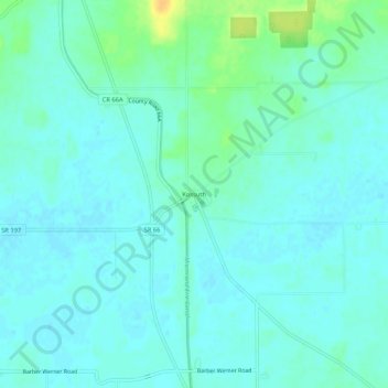
Name: Kossuth topographic map, elevation, terrain.

Location: Kossuth, Auglaize County, Ohio, 45887, United States (40.63949 -84.36801 40.67949 -84.32801)

Average elevation: 840 ft

Minimum elevation: 817 ft

Maximum elevation: 912 ft

Auglaize County trails, hiking, mountain biking, running and outdoor activities

Other topographic maps

Click on a map to view its topography, its elevation and its terrain.

Uniopolis

United States > Ohio > Auglaize County

Average elevation: 938 ft

Buckland

United States > Ohio > Auglaize County

Average elevation: 850 ft

Minster

United States > Ohio > Auglaize County

Average elevation: 968 ft

New Knoxville

United States > Ohio > Auglaize County

Average elevation: 906 ft

Waynesfield

United States > Ohio > Auglaize County

Average elevation: 1,063 ft

Saint Marys

United States > Ohio > Auglaize County

Average elevation: 876 ft

Cridersville

United States > Ohio > Auglaize County

Average elevation: 892 ft

Gear up for your next adventure:

📷Action Camera - Capture your outdoor adventures in HD
🪶Compact Camp Shovel - Folding shovel for campsite tasks
🧴Hand Sanitizer - Keep hands clean while hiking
🏔️Mountain Trail Maps - High‑detail maps for popular peaks
🛡️Insect Repellent - Protection against bugs during outdoor activities

As an Amazon Associate, this site earns from qualifying purchases at no extra cost to you.