
Bandora topographic map
Click on the map to display elevation.
About this map
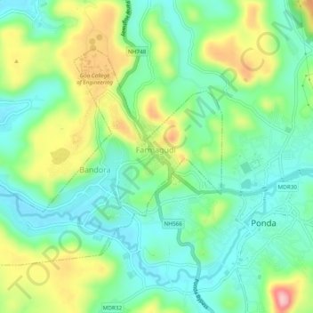
Name: Bandora topographic map, elevation, terrain.
Location: Bandora, Ponda, South Goa, Goa, India (15.39481 73.95232 15.42673 74.00007)
Average elevation: 200 ft
Minimum elevation: -3 ft
Maximum elevation: 600 ft
Other topographic maps
Click on a map to view its topography, its elevation and its terrain.