
Thank you for supporting this site ❤️
Make a donation
Make a donation
Gear up for your next adventure:
As an Amazon Associate, this site earns from qualifying purchases at no extra cost to you.
Tekyol topographic map
Click on the map to display elevation.
Thank you for supporting this site ❤️
Make a donation
Make a donation
Gear up for your next adventure:
As an Amazon Associate, this site earns from qualifying purchases at no extra cost to you.
About this map
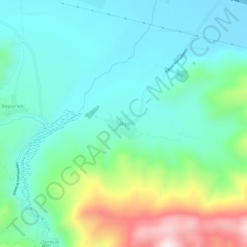
Name: Tekyol topographic map, elevation, terrain.
Location: Tekyol, Muş, Eastern Anatolia Region, Turkey (38.68461 41.55137 38.72461 41.59137)
Average elevation: 4,754 ft
Minimum elevation: 4,199 ft
Maximum elevation: 6,371 ft
Thank you for supporting this site ❤️
Make a donation
Make a donation
Gear up for your next adventure:
As an Amazon Associate, this site earns from qualifying purchases at no extra cost to you.