
Ramallah topographic map
Click on the map to display elevation.
Ramallah
Ramallah (UK: /rəˈmælə/ rə-MAL-ə, US: /rəˈmɑːlə/ rə-MAH-lə; Arabic: رام الله, romanized: Rām Allāh, lit. 'God's Height') is a Palestinian city in the central West Bank, that serves as the de facto administrative capital of the State of Palestine. It is situated on the Judaean Mountains, 10 km (6 miles) north of Jerusalem, at an average elevation of 872 meters (2,861 ft) above sea level, adjacent to al-Bireh.
About this map
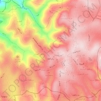
Name: Ramallah topographic map, elevation, terrain.
Location: Ramallah, Area A, West Bank, Palestinian Territory (31.88387 35.16453 31.92956 35.21024)
Average elevation: 2,608 ft
Minimum elevation: 1,785 ft
Maximum elevation: 2,920 ft