
Modhera Char rasta topographic map
Interactive map
Click on the map to display elevation.
About this map
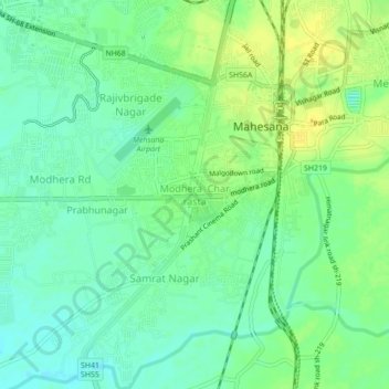
Name: Modhera Char rasta topographic map, elevation, terrain.
Average elevation: 289 ft
Minimum elevation: 256 ft
Maximum elevation: 328 ft
Other topographic maps
Click on a map to view its topography, its elevation and its terrain.
Bhasariya
India > Gujarat > Mahesana Taluka
Bhasariya, Mahesana Taluka, Mahesana District, Gujarat, 384435, India
Average elevation: 282 ft
Vadosan
India > Gujarat > Mahesana Taluka
Vadosan, Mahesana Taluka, Mahesana District, Gujarat, 384002, India
Average elevation: 269 ft
Modhera Circle
India > Gujarat > Mahesana Taluka > Mahesana
Modhera Circle, Rajivbrigade Nagar, Mahesana, Mahesana Taluka, Mahesana District, Gujarat, 384001, India
Average elevation: 289 ft
Mahesana
India > Gujarat > Mahesana Taluka
Mahesana, Mahesana Taluka, Mahesana District, Gujarat, 384001, India
Average elevation: 302 ft