
Sukarami topographic map
Interactive map
Click on the map to display elevation.
About this map
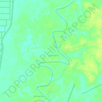
Name: Sukarami topographic map, elevation, terrain.
Location: Sukarami, Sungai Rotan, Muara Enim, South Sumatra, Indonesia (-3.20896 104.23152 -3.18510 104.28338)
Average elevation: 30 ft
Minimum elevation: 3 ft
Maximum elevation: 52 ft
Other topographic maps
Click on a map to view its topography, its elevation and its terrain.
Indramayu
Indonesia > South Sumatra > Muara Enim
Indramayu, Tanjung Agung, Muara Enim, South Sumatra, Indonesia
Average elevation: 1,076 ft